

Allied aerial photographs
The Allied air forces continuously took aerial photographs of enemy territory during their missions. Partly due to military reconnaissance measures, but also during bombing operations in order to be able to evaluate hits in the target area. There are also some photos of Cuxhaven here in varying qualities. Some of these images can be found on the NCAP website with the right search terms. Some examples:
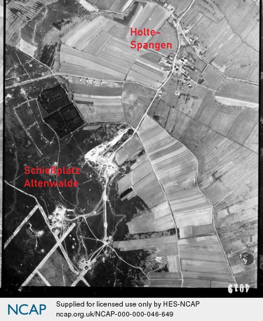
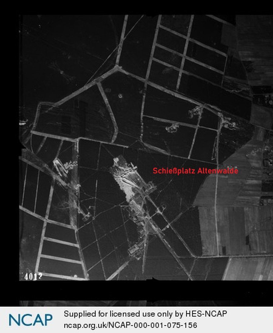
Holte - Spangen with the entrance via the Fuchskuhle to the Altenwalde shooting range
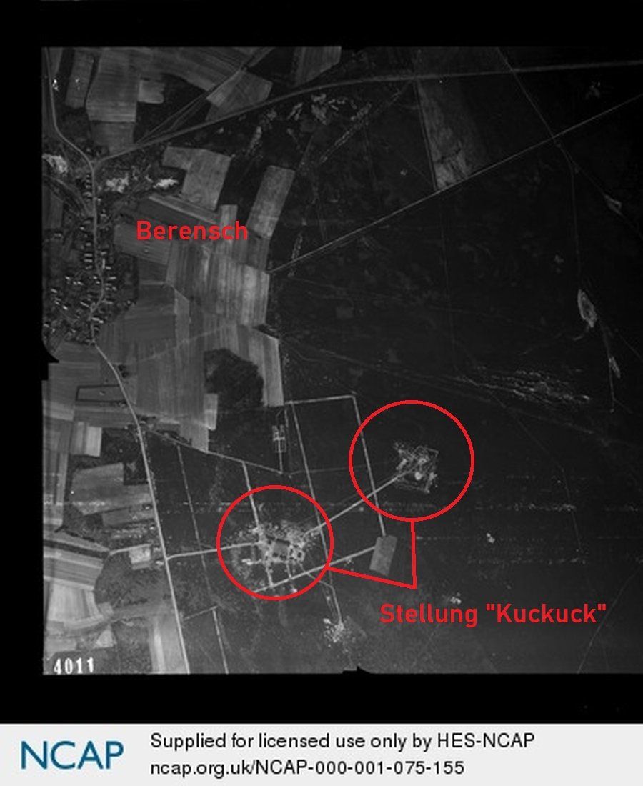
The radio measuring position "Kuckuck" near Berensch with its two FuMG 65/FuSE 65 Würzburg - giants after bombing.

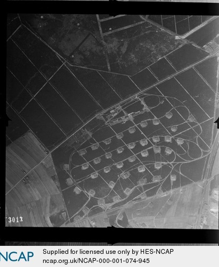
Bomb crater on a field in Westerwisch
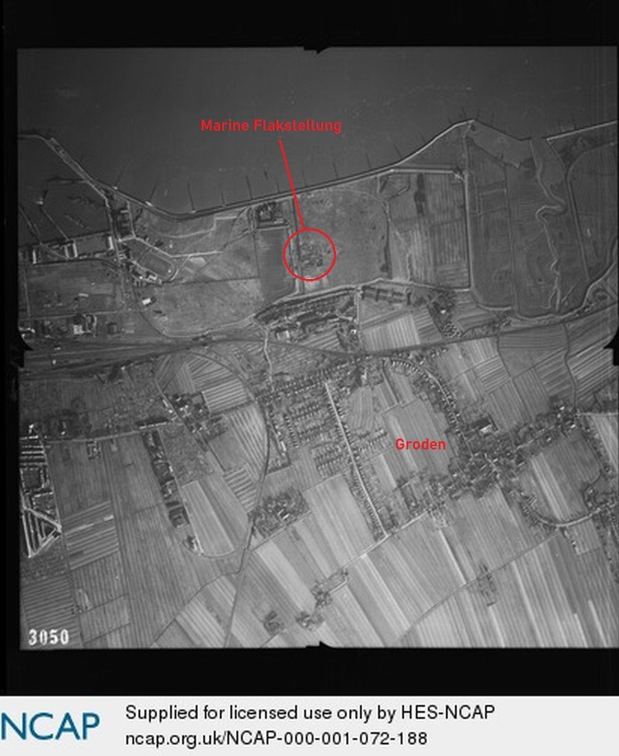
Cuxhaven - Groden
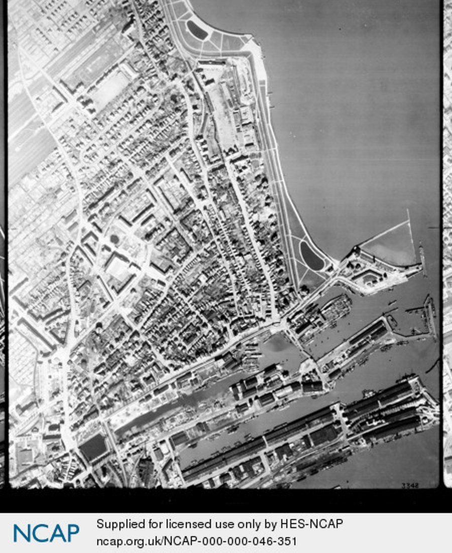
The Cuxhaven city centre with the harbour, the large cube in the middle is the town hall bunker.
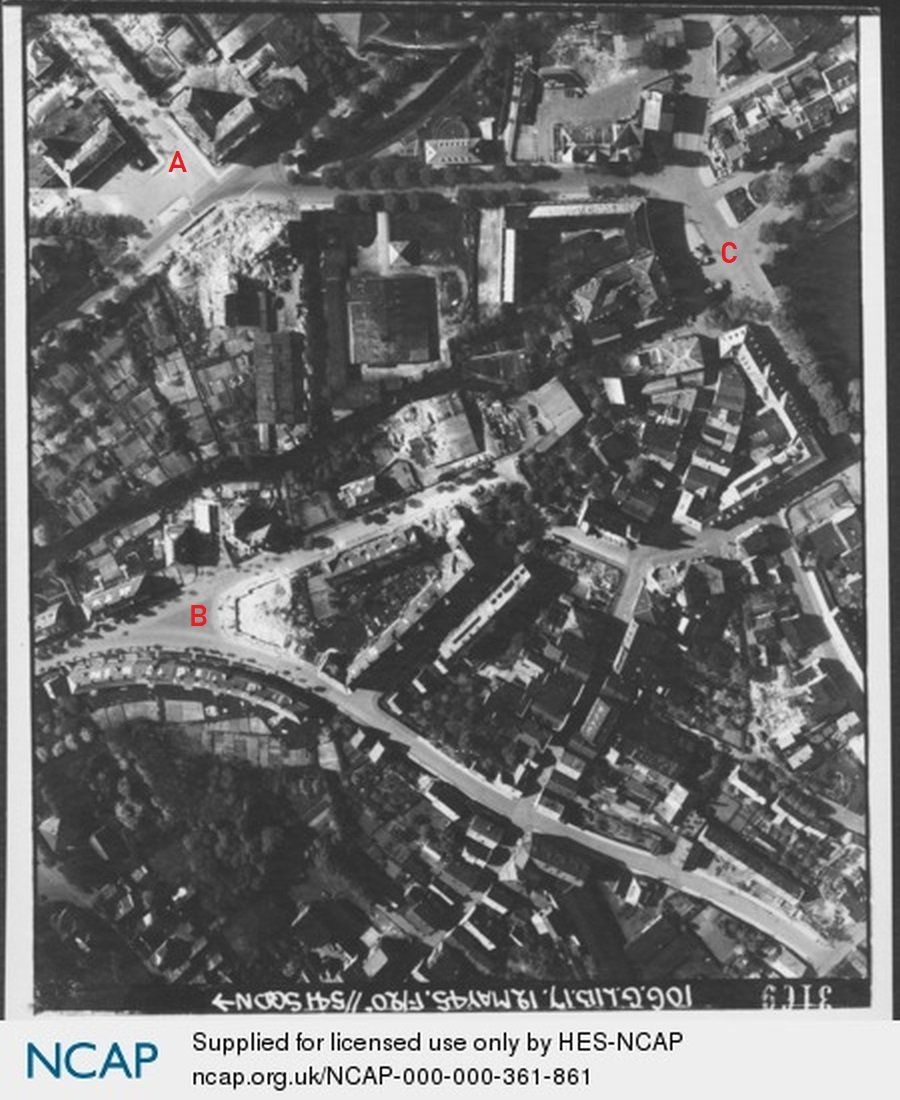
Cuxhaven's city centre, for orientation: A - Schulstraße with the fire station and today's VHS, B - Segelckestraße/Wetternstraße, C - Kaemmererplatz
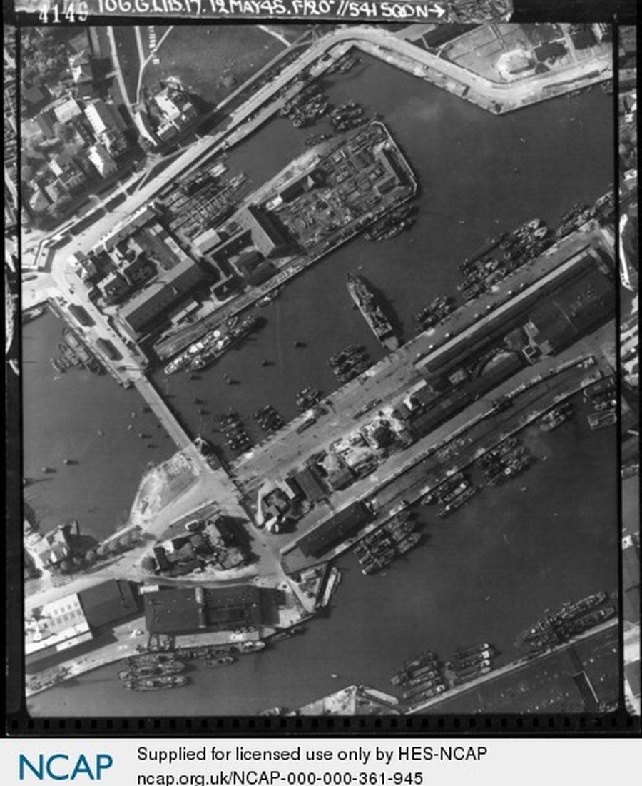
The area around the Old Harbor four days after the end of the war. In the middle is the Beckmann shipyard. Many naval ships from various units are in the harbors.